Chinese Scientists Want to Conduct Research in U.S. Waters—Should Washington Let Them?
In recent years, Chinese scientists—and the government agencies that back them—have fixed their gaze on American waters, especially those near the U.S. territory of Guam. This has raised questions about the ability of current policy to adequately protect U.S. interests.
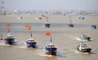
The People’s Liberation Army Navy (PLAN) is not the only element of Chinese sea power plying the world’s great waterways. Today, Chinese oceanographic research vessels routinely operate in strategically important areas of the Indo-Pacific region. From the deck plates of China’s large (and still growing) fleet of survey ships, Chinese scientists are pursuing their research agendas in exotic new places: Madagascar, Micronesia, Benham Rise in the Philippine Sea, the Arabian Sea and the Clarion-Clipperton Fracture Zone in the waters south of Hawaii.
The rapid expansion of China’s out-of-area—or “distant-ocean” (远洋)—oceanographic research operations raises important questions for Indo-Pacific nations. Many places of interest to Chinese oceanographers fall within the two hundred nautical mile exclusive economic zone of other countries. The United Nations Convention on the Law of the Sea (UNCLOS) empowers coastal states to decide whether to allow marine scientific research (MSR) in their exclusive economic zones. Should they approve Chinese MSR? If so, under what conditions? What if Chinese scientists are not doing what they say they are doing? What are the risks of ignorance?
As an Indo-Pacific country and the state with the world’s largest exclusive economic zone, the United States faces these same questions. In recent years, Chinese scientists—and the government agencies that back them—have fixed their gaze on American waters, especially those near the U.S. territory of Guam. This has raised questions about the ability of current policy to adequately protect U.S. interests.
American policy has long been to make the waters of the U.S. exclusive economic zone open and available to the activities of foreign scientists. In many cases, it does not even require a permit or advance notice to undertake MSR. While this policy is admirable for its robust endorsement of maritime freedom, this approach leaves the United States vulnerable to exploitation by the People’s Republic of China (PRC), a strategic competitor with an ocean agenda markedly different from our own.
Chinese distant-ocean MSR directly serves state interests, including security interests. Many of these operations are more akin to “military surveys,” similar to work done by U.S. Navy special mission ships like the USNS Bowditch. While military surveys are not unlawful, the fact that China disguises military surveys in the garb of MSR harms U.S. interests in at least two ways. It confounds America’s ability to accurately gauge the scale and content of Chinese data collection efforts. Moreover, it undermines the U.S. interest in maritime freedom by allowing China to pursue military aims without reciprocating these freedoms to the United States and other nation-states. To counter these harmful effects, Washington should more vigorously assert its coastal state rights under UNCLOS.
Chinese Marine Science: National Interest First, Science Second
In China, marine science is dominated by the state. This is especially true for out-of-area oceanographic research. Until recently, the State Oceanic Administration conducted the vast majority of marine science in distant ocean areas. Earlier this year, most of its responsibilities—including marine science—were transferred to the newly-created Ministry of Natural Resources.
Even research not conducted by the Ministry of Natural Resources is subject to its direction. In 2012, China took steps to combine most of the country’s research vessels into a National Fleet. Today, the fleet comprises fifty ships, half dedicated to out-of-area research. Modeled on America’s University-National Oceanographic Laboratory System (UNOLS), the National Fleet was created to systematize use of existing research platforms and better position the State Oceanic Administration to manage national oceanographic research activities. Aside from State Oceanic Administration ships, China’s National Fleet includes vessels from state-owned oil and gas companies, universities and research institutes like the Chinese Academy of Science. Unlike UNOLS, which comprises scientists from independent universities and research institutes, China’s National Fleet is overseen by a coordination committee headed by a government official.
Other governments, including the United States, heavily subsidize marine science. Indeed, the National Science Foundation and the U.S. Navy Office of Naval Research fund a number of civilian projects. Both own research vessels that are operated by civilian institutes and incorporated into UNOLS. Through its funding decisions, the U.S. government influences the national oceanographic research agenda, doing so with national defense considerations in mind. However, the UNOLS fleet and the civilian scientists that use it are not, as in China, direct extensions of state power, mobilized to achieve defined national strategic objectives.
Beijing primarily invests in out-of-area oceanographic research in order to position China to better compete with other countries for security, resources, markets and political influence. This self-interested spirit pervades many aspects of China’s foreign policy. In marine affairs, it can be traced to the highest levels of the Chinese party-state. In July 2013, the Chinese Communist Party held a Politburo meeting devoted to the topic of transforming China into a “maritime great power” (海洋强国). Rather than centering his remarks on the cooperative spirit of UNCLOS, General Secretary Xi Jinping conjured themes of national struggle against competing states: “Historical experience tells us that countries that embrace the sea prosper, while countries that forsake the sea decline.” Xi also highlighted the “increasing strategic status of the ocean in international competition in the political, economic, military, scientific and technological realms.”
These attitudes pervade current Chinese discourse on marine affairs. On February 11, 2018, for example, People’s Daily devoted a full page to the topic of China as a maritime great power. In one article, State Oceanic Administration official Zhang Haiwen (张海文) describes the ocean as “an important stage” upon which the countries of the world “strengthen their comprehensive national power, international influence, and competitiveness.” Therefore, Zhang writes, China’s efforts to accelerate its transformation into a maritime great power is “a major strategic action to ensure and satisfy China’s national security development needs, safeguard China’s maritime rights and interests, and expand China’s national strategic interests.” In a second article, former deputy director of the Chinese Academy of Military Science, Liu Jixian (刘继贤), called for China to “seize the dominant position in maritime strategic competition.”
Maritime competition is closely tied to Beijing’s ambitions to play a leading role in global affairs. On May 18, 2018, a website owned by the overseas edition of the People’s Daily published an article entitled “Why China Should Be a Maritime Great Power,” written by Jia Xiudong (贾秀东), a researcher at a think tank funded by China’s Ministry of Foreign Affairs. Jia declared: “The deep sea and the polar regions have become the new domain for international strategic competition.” Thus, in Jia’s view, “the only way for China to truly stand at the center of the world’s stage is by breaking through the restraints of the traditional maritime boundaries, and planting its feet firmly in the vast global ocean.”
This emphasis on international competition permeates the institutional cultures of Chinese oceanographic research institutes. In October 2016, the research vessel Dong Fang Hong 2 conducted a cruise to the Mariana Trench near Guam, where it recovered data from instruments moored to the ocean floor. Upon the ship’s return, the Qingdao National Laboratory for Marine Science and Technology, which led the expedition, posted a statement on its website. It declared: The age of international competition in the deep sea has begun. Vigorously carrying out deep sea research is a powerful initiative to expand China’s blue economy and safeguard China’s national security. It is vital for China to occupy the dominant position in the new round of deep-sea competition.
MSR or Military Surveys?
The statements cited above, and many others like them, demonstrate that Beijing’s interest in marine science is largely driven by national strategic objectives. Moreover, the state’s dominant role in marine science ensures that Chinese scientists can be directly mobilized to serve this national agenda. In recent years, one of the key functions of distant-ocean research has been to support China’s naval ambitions.
Since Xi Jinping came to power in 2012, China has invested vast resources to build itself into a world-class naval power. Once largely confined to the waters of the First Island Chain, the Chinese navy is now preparing to compete with American sea power in the western and central Pacific and in the Indian Ocean beyond the umbrella of its shore-based aircraft and missile batteries.
Beijing’s naval ambitions create a desperate need to improve its knowledge of the ocean battlespace environment in unfamiliar areas of the Indo-Pacific region. China mobilizes the country’s civilian oceanographers to help meet these new requirements. Their expertise is fundamental to countering U.S. submarines, which today represent the greatest conventional threat to China’s military aims. Whether conducted by ship, aircraft or other submarines, effective anti-submarine warfare requires detailed knowledge of the undersea domain. This starts with data on seabed bathymetry and geology, which are fundamental to undersea operations. It also includes the ability to forecast dynamic environmental phenomena such as surface and internal waves, sound speed, surface and undersea currents, and other factors affecting navigation, the performance of combat systems and underwater sound propagation.
Chinese oceanographers openly acknowledge the undersea warfare applications of their work. In January 2015, a State Oceanic Administration newspaper published an article entitled “The Strategic Value of Scientific Expeditions in the Western Pacific.” The article summarizes the views of two Chinese scientists about the importance of Chinese oceanographic research in the Philippine Sea. They explain: Safeguarding China’s maritime rights and interests and naval activities require the ability to obtain and assess real-time, accurate marine environmental information from multiple domains, making the water column and sea bed become transparent. Marine research is an important scientific support for assessing the environmental situation within the modern ocean battle space.
Civilian oceanographers help make the ocean “transparent” for the Chinese navy in several ways. First, they share data. This was the case during an August 2017 cruise by the Chinese ship Kexue, in waters near Guam. Interviewed by a Hong Kong-based newspaper, embarked scientist Xu Kuidong (徐奎东) admitted that he and his colleagues had made several “exciting discoveries” that would be shared with the Chinese military. Indeed, a key purpose of the ship’s operations was to collect oceanographic information to help the PLAN effectively operate beyond the Second Island Chain, the strategically important archipelago extending from Japan to Indonesia via the Bonin Islands, Mariana Islands, Yap and Palau.
In other cases, Chinese civilian scientists help create new knowledge valuable to the Chinese military. For example, the Qingdao National Lab is leading a hugely ambitious project to build a network of fixed sensors extending from the Western Pacific to the Indian Ocean. This initiative, called the “Transparent Ocean Project,” seeks to collect real-time or near-real-time data on ocean currents, temperature, salinity and other parameters. This data will be used to develop models for predicting oceanic conditions that impact naval operations. The lab’s director, Wu Lixin (吴立新), routinely touts the value of this project for Chinese national defense. Indeed, the lab has assigned a senior Chinese oceanographer named Hu Dunxin (胡敦欣) to oversee the project’s military side. When asked by a Chinese reporter about how he defined “transparent,” Hu described it as the ability to observe the ocean and “clearly see everything inside.” If successful, this project could imperil U.S. submarine operations in strategically important ocean areas.
Civilian oceanographers also work on joint projects with the Chinese navy. In January 2009, the State Oceanic Administration signed a cooperative agreement with the PLAN, which was just beginning to expand operations in the Philippine Sea and Indian Ocean. Since then, State Oceanic Administration scientists and engineers have been tasked with helping the navy prepare for the new operating environments, including through joint research projects. Other institutions, such as the Qingdao National Lab, also work closely with the military. Together with the PLAN Submarine Academy, it operates the Joint Laboratory for Maritime Civil-Military Integration, which focuses on projects to bolster PLAN mastery of the undersea environment. Relationships of this kind are a major priority for Xi Jinping. Indeed, on a June 2018 visit to the Qingdao National Lab, Xi emphasized the importance of civil-military integration and the role of marine science in national defense.
UNCLOS defines MSR as research conducted to “increase scientific knowledge of the marine environment for the benefit of all mankind.” China’s distant-ocean research clearly does not meet this standard. Indeed, some significant share of these activities may be more aptly classified as military surveys, i.e., the “collection of marine data for military purposes.” This fact has major implications for U.S. policy.
The Costs of Weak MSR Policy
Current U.S. policy governing foreign MSR traces its roots to the Reagan era. In a March 1983 statement, President Ronald Reagan waived America’s coastal state rights to exercise jurisdiction over foreign research activities within the U.S. exclusive economic zone. For his rationale, the president cited a desire to promote marine scientific research and avoid “unnecessary burdens.” Today, the United States only requires foreign scientists to apply for permission through the U.S. State Department in a limited number of circumstance, such as if the research will be conducted within a national marine sanctuary or involves the study of marine mammals or endangered species.
This liberal policy applies to Chinese MSR. Indeed, the policy allows Chinese scientists to access the most sensitive of locations without oversight. For example, taking advantage of the open U.S. government policy, in June 2018 the Kexue freely operated in the U.S. exclusive economic zone west of the Mariana Islands. As required by international convention, the Kexue transmitted signals indicating its identity, location, course and speed. Commercially-available data show the ship approached as close as twenty-five nautical miles to the U.S. territory of Guam, home to two large military bases, including Naval Base Guam, which was just then hosting warships from India and Japan as part of the Malabar Exercise.
The Kexue had a plausible scientific purpose for being there: these waters contain several active submarine volcanoes. Reports from the Chinese press claim that the ship’s embarked scientists sought nothing more than to film and sample hydrothermal vents on the seafloor. Yet, seen in the context of China’s overall approach to marine science, this story seems far from complete.
In principle, it would not matter if Chinese oceanographic research vessels like the Kexue were conducting military surveys in the U.S. exclusive economic zone. International law allows it, and maritime freedom is a core U.S. interest. Indeed, U.S. policy has long distinguished between MSR, which a coastal state has the authority to regulate in its exclusive economic zone, and military surveys, which remain an international freedom. The fundamental problem is that China makes no distinction between the two. On this basis, it interferes with U.S. military surveys in the waters off its coasts. Accordingly, in combination, U.S. and Chinese policies are harming American interests. Beijing is able to reserve the right to oppose—and sometimes physically obstruct—U.S. Navy ocean surveillance and hydrographic survey activities, which it has repeatedly done in the Yellow Sea, East China Sea and South China Sea, while performing the same operations in American waters under the guise of scientific research. This allows China to continue to pressure American military surveys while concealing its own intentions.
The PRC has a long history of disguising military activities in civilian garb, especially in the maritime realm. The first time PLAN sailors traversed the First Island Chain was not aboard a warship, but a white-hulled State Oceanic Administration research vessel. In March 1976, China sent Xiang Yang Hong 05 and Xiang Yang Hong 11 on a highly-classified expedition to the South Pacific to survey sites for an intercontinental ballistic missile testing range. PLAN officers wore “Mao suits” and pretended to be civilian scientists, their photos shown in the Chinese press to sustain this fiction. Writing in a late 2016 issue of a State Oceanic Administration periodical, a group of Chinese researchers, four of whom work for the State Oceanic Administration’s First Institute of Oceanography, highlighted the value of using Chinese civilians to collect environmental data in the Atlantic Ocean. Sending warships to conduct surveys, they explain, might increase the risk of hostile reactions from other states. “Scientific investigation, on the other hand, is ocean exploration for the public good. Therefore, it seldom attracts attention.”
Reclaiming America's Coastal State Rights
Washington clearly needs to update its MSR policy to better cope with the China challenge. It should focus on two key aims. First, it should strive to better understand which Chinese operations are for scientific advancement and which are military surveys. Our research shows that the PRC has mobilized Chinese oceanographers to directly support the country’s transformation into a premier naval power. But what precisely are they doing to serve this aim? A solid understanding of the scale and content of these activities in U.S. waters is vital for accurate threat assessments. By requiring permission for states to conduct MSR in American waters, U.S. authorities would be better able to identify those Chinese vessels that are operating in U.S. waters to achieve a purely military objective. Second, the United States should insist on reciprocity. Simply put, U.S. ships conducting military surveys in Chinese waters should be accorded the same respectful treatment that Chinese vessels have always received in U.S. waters. Thus, this shift in policy would advance two important objectives—it would impose more clarity about the nature of Chinese operations in American waters and it would establish a stronger basis for reciprocal respect for American military surveys in Chinese waters.
Asserting U.S. coastal state rights can go a long way to achieving both of these aims. The United States should begin by asserting its prerogatives to approve all Chinese MSR activities in U.S. waters. At the very least, their MSR applications will reveal what Chinese oceanographers claim they intend to do in America’s exclusive economic zone. This information can be checked against other sources, such as reconnaissance flights by U.S. Navy patrol aircraft. If a Chinese vessel is found operating in U.S. waters without consent, the United States can assume the vessel is undertaking a lawful military survey. A policy shift will not stop such Chinese operations. But it will give the U.S. leverage to require reciprocal treatment for U.S. vessels in Chinese waters.
UNCLOS also gives coastal states the right to insist on participating in all foreign MSR projects in their exclusive economic zones. The United States could require Chinese research ships to embark American observers, perhaps from the National Oceanic and Atmospheric Administration or the U.S. Coast Guard. UNCLOS further stipulates that coastal states can request records of all data collected—another opportunity that the United States should not pass up. By asserting these rights, the United States can gain a much more complete understanding of PRC oceanographic research activities.
These straightforward steps can be taken right away as a matter of Executive Policy. However, they should be followed by a more thorough evaluation of U.S. policy vis-à-vis Chinese MSR. This should happen sooner rather than later. Beijing’s oceanographic activities are expanding at a rapid pace, and its ambitions do not end at the Second Island Chain. In the coming years, Washington can expect Chinese scientists to seek access to waters near Alaska, Hawaii, and eventually the coasts of continental United States. What will our policy be then?
Ryan D. Martinson is an assistant professor in the U.S. Naval War College’s China Maritime Studies Institute. He researches Chinese maritime strategy. His views do not reflect the views of the U.S. government.
Peter Dutton is a professor of strategic studies and director of the China Maritime Studies Institute at the U.S. Naval War College. Professor Dutton's current research focuses on American and Chinese views of sovereignty and international law of the sea and the strategic implications to the United States and the United States Navy of Chinese international law and policy choices. His views do not reflect the views of the U.S. government.